Przystanki autobusowe - zbiorcze
Warstwa zawiera przystanki autobusowe ZDW (edycja ZDW) oraz przystanki UM Kraków (pobierane ze strony ZTP).
ExportMunicipalities – Sites from Municipal Heritage Registers
The map presents the locations and selected data on immovable monuments in the Małopolskie Voivodeship, based on municipal heritage inventories maintained by commune heads (mayors and city presidents).
OpenMunicipalities – Sports Fields, Playgrounds and Other Activity Facilities
The map presents the locations and descriptions of sports and recreational facilities located within the municipalities of the Małopolskie Voivodeship.
OpenMunicipalities – Points of Interest
The map presents the locations and descriptions of noteworthy places to visit within the municipalities of the Małopolskie Voivodeship.
OpenThe grant „Małopolska Pamięta”
The map composition presents the location of small architecture objects for which the Lesser Poland Voivodeship has granted funding for renovation.
OpenMunicipalities – Cultural Events
The map presents the locations and descriptions of events taking place within the municipalities of the Małopolskie Voivodeship.
OpenThe composition presents the VeloMałopolska network of bike trails, selected bike routes, and suggestions for bike tours in Małopolska.
OpenThe grant "Chapels of Malopolska"
The map composition presents the location of small architecture objects for which the Lesser Poland Voivodeship has granted funding for renovation..
OpenThe grant "Protection of monuments in Małopolska"
The map application presents the location of monuments for which the Małopolska Voivodeship has granted funding.
OpenMałopolski Festiwal Smaku 2026
Małopolski Festiwal Smaku 2026
OpenHospitals, wards, emergency rooms and emergency departments
Hospitals, wards, emergency rooms and emergency departments of the Lesser Poland Voivodeship.
OpenRegister of pharmacies of the Lesser Poland Voivodeship
OpenTransport accessibility to Nowy Sącz
Transport accessibility to Nowy Sącz
OpenTransport accessibility to Tarnów
Transport accessibility to Tarnów
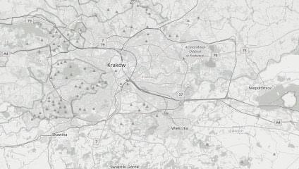
OpenTransport accessibility to Kraków
Transport accessibility to Kraków
OpenTransport accessibility to the county seat
Transport accessibility to the county seat
OpenTransport accessibility to the municipal seat
Transport accessibility to the municipal seat
OpenMapa dostępności komunikacyjnej (kolej i MLD) - 05.2026
Atlas map dostępności komunikacyjnej (kolej i MLD) RR
OpenMapa dostępności komunikacyjnej (kolej i MLD) - 11.2025
Atlas map dostępności komunikacyjnej (kolej i MLD) RR
OpenThe map composition presents villages that have been awarded or recognized in the Małopolska Village contest (previously Unusual Małopolska Village)
Open

